1. Description#
The SkyHub solution is a hardware and software set designed to enhance commercial-off-the-shelf UAV capabilities for industrial purposes and to support integration of diverse sensors.
SkyHub solution functions:
Data collection from sensors like GPR, methane detector, echosounder, etc. which do not have an internal data logger. Data is recorded in CSV format as well as in formats compatible with specialized software for sensor data processing and analysis (SEG-Y, NMEA-0183, etc.).
Data fusion from the payload and UAV telemetry. Data without coordinates (non-geotagged) is in most cases useless. SkyHub uses the positioning information from the drone to geotag sensor data.
SkyHub can supply a NMEA coordinate stream to external sensors. Some sensors have internal data recorders but require an external GPS receiver. SkyHub can act as an additional GPS receiver by providing the UAV coordinates to sensors.
Support for True Terrain Following for DJI drones to automatically keep constant elevation over the surface using real-time data from a radar or laser altimeter.
Support for Grasshopper mode for DJI drones. The mode provides flight between waypoints at a safe altitude and descends at waypoints to the set altitude to make measurements (using NDT sensor, echo sounder, etc.) or to drop a parcel or seismic sensor.
Support for an external detector of obstacles to interrupt the flight and save the UAV, especially if the weather conditions or payload configuration interfere with the built-in sensors on the UAV or the UAV does not have such sensors.
Supports power output up to 5V/1A via the USB port.
1.1. Compatible drones#
DJI Matrice 400
DJI M350 RTK
DJI M300 RTK
Pixhawk-compatible (Cube) autopilots with ArduPilot or PX4 firmware
1.2. Interaction diagrams with drones#

DJI SDK drone interaction diagram#
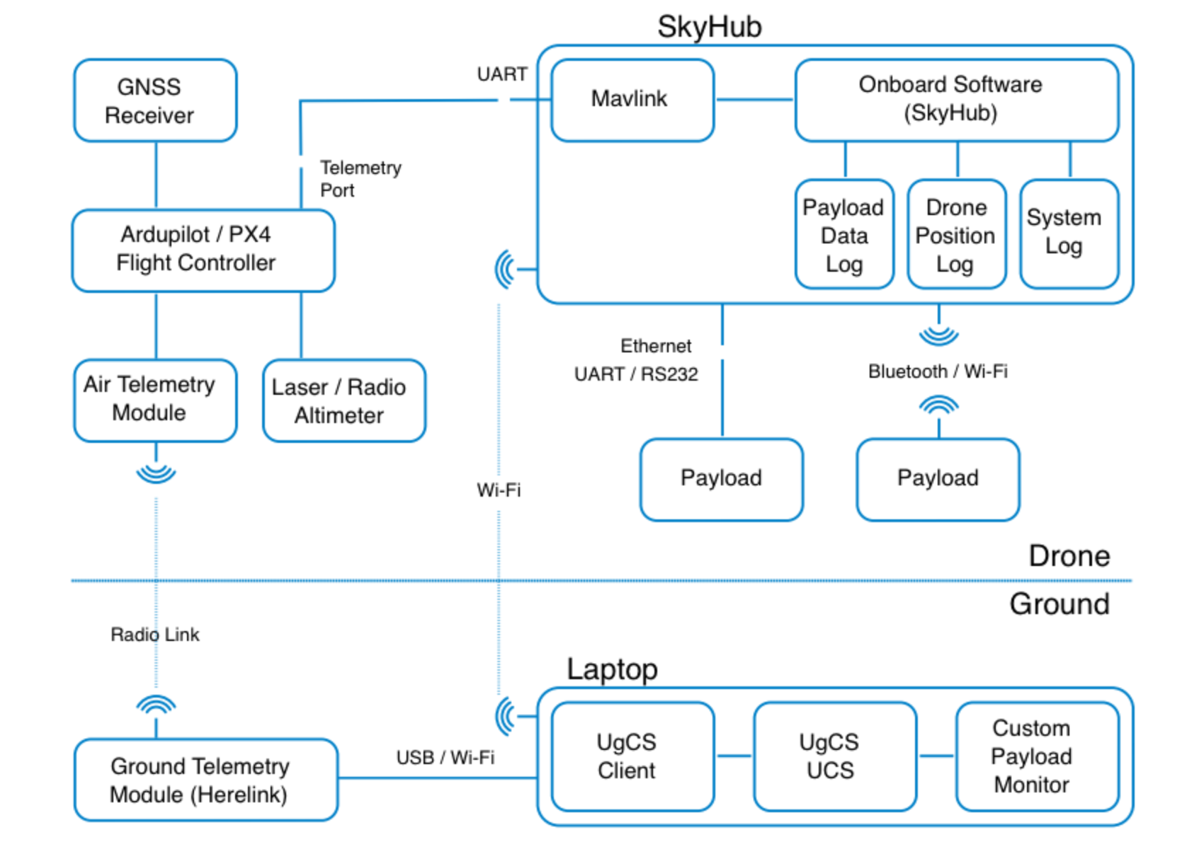
Pixhawk autopilot based drone interaction diagram#